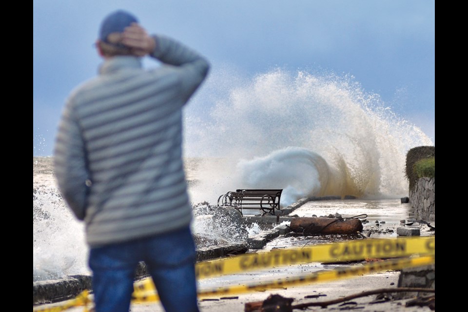
North Shore residents and crews are cleaning up after a fall storm for the record books.
“It’s a pretty intense atmospheric river that we’ve seen here on the South Coast over the past 36 hours or so and it’s given copious amounts of precipitation,” said Bobby Sekhon, meteorologist with Environment and Climate Change Canada.
The West Vancouver station recorded 157 millimetres of rain between 11 a.m. on Saturday and 11 p.m. Monday. On Mount Strachan, they calculated 222 millimetres in that same time period.
Heavier rainfall volumes were recorded farther east with severe flooding in the Fraser Valley and major damage to infrastructure.
By noon on Monday, the Capilano River’s flow rate peaked at about 500 cubic metres per second. Storms of that strength on the Capilano are considered a one-in-five-year event, according to preliminary numbers provided by Jesse Montgomery, Metro Vancouver’s division manager for the watershed.
The Seymour River’s flow rate reached approximately 390 cubic metres per second – more than 10 times the rate from the previous Monday.
“That’s about a one in 40 return period, so much more significant for Seymour,” Montgomery said. “We’ve certainly seen it in recent memory and, attributed to climate change, we’re certainly seeing these events occur with higher frequency than the return periods might indicate.”
A few homes along the Seymour received flood damage, said Gavin Joyce, director of engineering for the district, and another 20 were impacted by sewer and storm drain back-ups. There was also some localized flooding in other areas, which crews were able to quickly deal with.
In the last decade, the district has invested millions of dollars in storm water infrastructure, Joyce said, in Grousewoods, on Kilmer Creek and most recently, a new storm drain running down Gallant Avenue in Deep Cove.
“That functioned quite well yesterday on a very, very heavy event,” he said. “I’m very pleased that the council saw a way to invest in that infrastructure in the last decade. … A storm like that in the ’80s and ’90s would have absolutely flattened us.”
While the rain petered out around noon on Monday, it was quickly followed up with a windstorm that brought sustained 70 kilometre-per-hour winds to the North Shore, and gusts that measured as high as 106 km/h at Point Atkinson.
Hazardous conditions led Metro Vancouver and the municipalities to close parks in wooded areas. Lynn Canyon Park and the Ecology Centre were expected to reopen late Tuesday, but the Baden Powell Trail on the west side of the canyon was “heavily damaged,” Joyce said.
“That will be closed until such time we can assess it. It will be quite a while before we can get the work done there to have that trail reopened,” he said.
Over the course of the day, thousands of properties between Horseshoe Bay and Deep Cove were without power, due to downed trees on wires.
The District of West Vancouver was forced to close the Centennial Seawalk Monday, which was battered by waves and debris. West Vancouver spokeswoman Donna Powers said they expect the staff hadn’t done a full damage assessment yet they expect path to be reopened late Tuesday.
And West Vancouver was also dealing with sewage back-ups in Ambleside.
“Basically, all of the rainwater infiltrates Metro Vancouver’s sewer line, and then it backs up onto Ambleside Lane and Marine Drive. This happens every time we have heavy rainfall,” said Donna Powers, district spokeswoman. “Obviously, this is one of the heaviest we’ve had in a while.”
Metro Vancouver had staff on site for much of the weekend and Monday with vacuum trucks to suck up the waste.
Both Joyce and Powers expressed sympathy for residents of the Fraser Valley and Merritt, who have been completely flooded and had their highways washed out.
“We got off so lucky but it was so devastating to see what’s happened around the province,” Powers said. “I can’t remember a time that the Lower Mainland was cut off from the country.”
On Tuesday, North Shore Rescue was called to assist with evacuating residents of Merritt who were left stranded by flood waters.
“It could have been an awful lot worse for the district,” Joyce said. “It’s sobering in the sense that this is likely a reoccurring event here now going forward with where we are with climate change.”
That is Twin Falls Bridge on Lynn Creek at 10am... Major Flood! #BCStorm pic.twitter.com/JCoVLwitFP
— Brad Atchison (@Brad604) November 15, 2021
Another angle of Twin Falls this morning in #NorthVan. #BCFlood #BCStorm pic.twitter.com/IOLQ9b7sUQ
— Lee Rippon (@LD_Rippon) November 15, 2021
The view from the Lynn Canyon Suspension Bridge... #BCStorm #ShareYourWeather pic.twitter.com/b6ZtI9aPbc
— Brad Atchison (@Brad604) November 15, 2021


