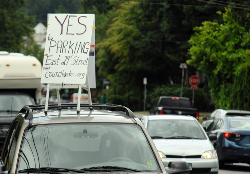
It was a bumpy ride, but bike lanes will roll through East 29th Street and about 160 out of 200 parking spots will be scrapped following one last council debate Monday.
Council approved the $1.454-million project at a May 27 meeting but reopened debate July 22 following outcry from residents.
In a last effort to find a compromise, Coun. Lisa Muri advocated for limiting bike lanes to the north side of the street.
“Just press pause,” she urged her colleagues. “I’m not asking for a delay to study it more, I’m asking for a delay to study the impacts.”
Residents are searching for a compromise, Muri said.
“I have not heard anybody say: ‘I own that road, it’s my parking spot, don’t take it away,’” Muri said.
Council’s commitment to bicycle lanes is: “our commitment to the future,” said Coun. Jim Hanson.
“If we were to abandon this proposal ... I believe it would leave us appearing insincere in our commitment to cycling infrastructure and active transportation,” he said.
In a bid to soften the blow to residents, Hanson assured the packed gallery he would consider drop-off and pickup zones as well as the “liberalization of parking variances on private land.”
Every property along the bike route has on-site parking, according to a district staff report. Residents can use up to 40 per cent of their front yard for parking.
Living on what she called: “the last leg of the rat run,” Coun. Betty Forbes discussed her fears of cyclists being doored and killed.
“I had trouble finding a compromise,” Forbes said, explaining she valued safety ahead of everything else.
Mayor Mike Little was the lone supporter of Muri’s compromise motion.
Having driven and ridden along the road frequently, Coun. Jordan Back judged the plan: “the safest option for all road users.”
New bike lanes are often opposed, Back said, noting that 10 years after its controversial launch, the Burrard Street path became the busiest bike lane in North America.
Heading west, cyclists will be able to pedal from Lynn Valley Road along East 29th Street, cross the street to a two-way bike lane west of Royal Avenue and then head down Tempe Crescent to East 27th Street, avoiding the huge hill on 29th Street.
That route is “the most logical and convenient connection” across the top of the district, according to Coun. Mathew Bond.
Calling the district’s cycling infrastructure: “completely inadequate,” Coun. Megan Curren emphasized the need to provide safe alternatives to vehicles.
The project is entirely designed to protect vehicle traffic, Muri countered.
“It’s all to accommodate more car volume coming through that corridor and we’re trying to get away from the car,” she said.
“Let’s slow the cars down. ... Let’s put some bumps in and let’s shift that traffic where it should be going: back onto that [Highway 1].”
Putting speed humps on arterial roads can result in more cars on collector streets, said district engineering services manager Steve Ono.
No one on council seconded Muri’s call for speed humps along the route.
The meeting ended with Muri remarking that it was “unfortunate” council didn’t find a compromise, eliciting an ovation and cries of “hear, hear!” from the gallery.
The changes were supported by neighbour George Hill, who said he’s struggled with the dangers of the route since crossing East 29th Street on his way to Boundary Elementary as a child.
Currently, cyclists need to “thread the needle” between parked cars and vehicles accelerating uphill.
“I would urge council to consider the safety and encouragement of all transportation modes over the protection of inefficient, unnecessary and private use of a public space,” Hill said.
In addition to parking concerns, residents objected to the lack of consultation, driveway access and challenges faced by residents with mobility issues as well as logistical problems for home-based businesses that depend on deliveries.
District staff are planning to incorporate two HandyDART loading zones along the route.
The district is also considering adding loading zones between driveways or on side streets to accommodate businesses. New buffer zones are designed to steer traffic away from driveways and open up sightlines.
Approximately 120 parking spots are being removed to accommodate cyclists while 40 spots are being lost in favour of left-turn lanes, sidewalks, and transit stops.
Data collected in 2016 and 2019 found the parking demand in the corridor averages about 40 per cent.


