The District of North Vancouver is heeding staff’s advice when it comes to prioritizing how it will manage its debris and flood-prone creeks.
Fiona Dercole, the district’s section manager for public safety, noted the priorities in a report recently delivered to council.
These include: managing creeks with the highest likelihood of posing a risk to life, direct damage to buildings or infrastructure, or having the potential to affect a high number of properties.
With the help of BGC Engineering Inc., staff recently completed a debris and geohazard risk assessment on 35 creeks across the district in order to provide these recommendations.
“Most of them are steep mountain creeks and are prone to what’s called debris flooding, which means there is a higher concentration of mud, rocks, tree debris and sediment.
These debris flood events occur primarily during the wet winter months and can be highly destructive to anything in their path,” Dercole explained.
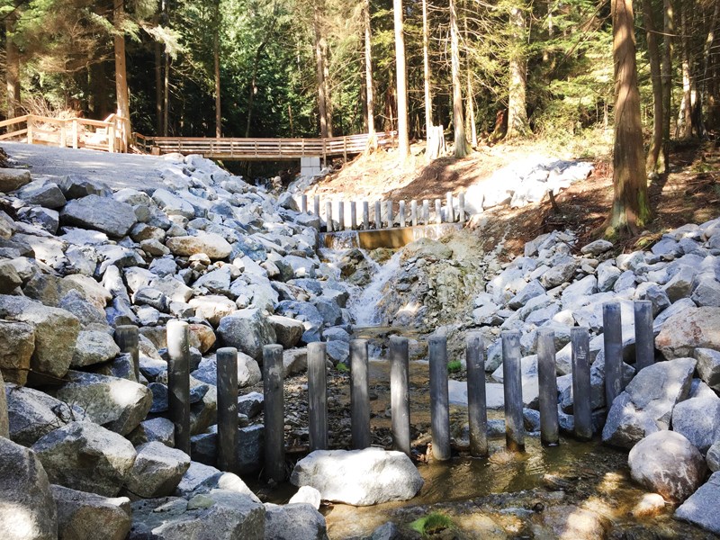
The report specifically identified Thames, Kilmer and Gallant creeks as being the district’s highest priorities. Dercole said work was already underway to reduce risk.
“For example, at Kilmer Creek we have built a debris basin and some debris retention structures,” she said.
She added that Thames and Gallant creeks will have sediment basins installed in August.
Although risk to public safety and property were identified as top priorities, updating municipal infrastructure that may be impeding certain creeks, as well as overall feasibility, were also listed as factors to consider.
The district has been analyzing debris flood risks over the past 20 years and its last comprehensive assessment was more than 10 years ago.
According to Dercole, the district’s latest assessment incorporates new information on climate change’s impact on flooding and a more thorough analysis of storm drainage infrastructure.
“Managing debris is part of that system,” she said. “Our aging storm drainage infrastructure was designed to the standard of the day, which was to handle clear water flows and smaller flows than we’re receiving today.”
Dercole said the district was committed to making as much information as possible available to residents.
“There’s 10 properties that have risks that exceed our risk-tolerance criteria and most of those properties are up Indian Arm and they are boat-access only. They’re seasonal use cabins, for the most part,” she said.
Dercole added that there’s a handful of properties near Panorama, Gavles and Percy creeks that also exceed the risk-tolerance criteria, but the district had already been informing and working with those property owners to cost-share some of the mitigation work.
“We have a responsibility to understand the hazards and risks that our community faces and make that information available to the people that are exposed to the risk,” she said.
In the next few weeks, residents should be able to access a copy of the report at geoweb.dnv.org.


