A new city report that examined what a 7.2-magnitude earthquake could do to Vancouver concluded that up to 1,350 people would die or suffer severe injuries and nearly 6,100 privately owned buildings would be heavily damaged.
The report prepared by Micah Hilt of the City of Vancouver and Dr. Tiegan E. Hobbs of Natural Resources Canada said such an earthquake would also result in the disruption and displacement of more than one-third of residents and workers for several months.
The authors estimated direct financial losses at $17 billion.
“Even a less intense earthquake, like the one used in the city’s 2019 VanSlam earthquake exercise, could leave as many as 25,000 residents and workers disrupted and displaced for more than three months, and cause as many as 200 severe injuries and fatalities,” said the report, which focused on privately owned buildings.
The conclusions were based on the authors using software that modelled a 7.2-magnitude earthquake centred in the Georgia Strait. The modelling incorporated a detailed building inventory developed by city staff.
The assessment showed that a set of five building types drive nearly 80 per cent of citywide risk in terms of severe injuries, fatalities and long-term disruption and displacement.
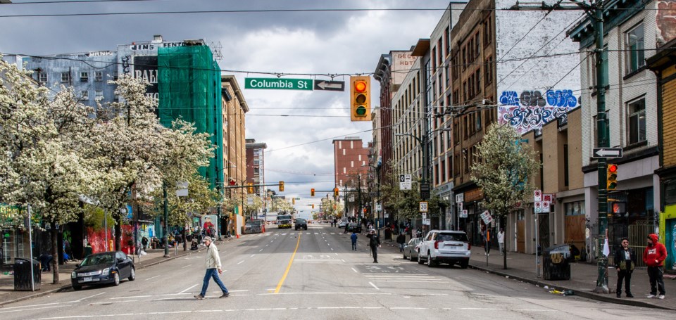
The highest concentration of risk was found in the West End, the Downtown Eastside (including Chinatown, Strathcona), downtown, Kitsilano, Fairview and Mount Pleasant.
“These six highest-risk neighbourhoods collectively contribute an average of 65 per cent of citywide seismic risk while containing the city and region’s two largest employment districts and over two-thirds of purpose-built market rental units in the city’s densest residential neighbourhoods,” the report said.
The building types contain the majority of the city’s total housing units, including 80 per cent of purpose-built rental units, as well as downtown offices and neighbourhood-serving small businesses.
Renters at risk
Not all buildings are equally at risk.
“We know from modelling and engineering expertise that buildings built prior to early modern seismic design requirements [1990] and, even more critically, buildings built prior to the introduction of seismic design requirements [1973] are at the highest risk of heavy damage resulting in casualties and long-term occupant disruption and displacement,” the report said.
This finding, the authors said, is concerning because existing older purpose-built rental buildings provide relatively affordable housing options in the private market due to their age and longer tenancies.
A recent Canada Mortgage and Housing Corporation survey found that average rents in Vancouver for units built pre-1960 are approximately 35 per cent less than rents for units built from 2015 onwards.
Analysis of census data from “moderate-to highest-risk tracts” within these neighbourhoods indicated that, on average, nearly 70 per cent of the population are renters.
Among those renters, nearly 20 per cent are low-income, more than 10 per cent are seniors, 30 per cent identify as visible minorities and four per cent are Indigenous peoples.
“These groups may face additional challenges and structural barriers in preparing their households and recovering from an earthquake, exposing them to potentially greater risk than other residents,” the report said.
'On-street injuries, fatalities'
From past earthquakes elsewhere, the authors said that cordoning off areas of the city is often required. Cordoning is where areas with high concentrations of damage are closed to access by the government for weeks, months, or even years at a time.
Areas such as the West End, containing many older mid-and high-rise concrete multi-unit residential buildings, and the Downtown Eastside, containing many unreinforced masonry, are particularly at risk for cordoning.
“Cordoning preserves life safety during earthquake response but extends the duration and difficulty of recovery, increasing long-term social and economic impacts,” the report said.
“Commercial high streets and arterials throughout the city, containing many unreinforced masonry, wood and low-rise concrete commercial buildings, are also at high risk. These streets, as well as streets throughout the Downtown Eastside and Downtown, have an additional risk of on-street injuries and fatalities from falling building debris.”
Along many arterials, such as Hastings Street, Kingsway and others, on-street debris is likely to cause emergency response and transportation blockages, as well.
“These blockages both increase the impacts of earthquake damage and, like cordoning, extend the duration and difficulty of recovery, and increase long- term social and economic impacts,” the report said.
'Challenging risk reduction action'
The authors say seismic risk reduction action need not be taken all at once.
It can start with small, strategic actions in a limited number of highest-risk buildings and in a limited set of at-risk areas of the city, they said.
“Small actions that quickly build on existing city policies and programs have the added advantage of promoting awareness and positioning the city well to pursue additional provincial and federal government funding and tools in support of further, more challenging risk reduction action,” the report said.
“The sooner Vancouver begins to take action to reduce risk, even if initially modest, the less challenging it will be to protect residents and ensure recovery in the long term.”
The report is scheduled to go before city council Nov. 12.


