The Canadian government has activated a new coastal flooding prediction and alert system to warn of storm surge, large waves and high tides across the Pacific, Atlantic and Arctic coasts.
Until now, coastal flooding alerts were only issued on the Atlantic coast.
But a new system from Environment and Climate Change Canada announced this week expands those operations to areas at risk of coastal flooding across the country.
Climate change is driving more frequent and intense extreme weather events, Minister of Environment and Climate Change Steven Guilbeault said in a statement.
“With these expanded services, we will be able to provide Canadians and our emergency management partners across the country with critical, early information about the risk of coastal flooding, enabling better preparation and faster responses,” said Guilbeault.
'Risk rating'
The expanded system will use new modelling techniques and a coastal flood risk index to evaluate the likelihood and expected impact of an event.
Government meteorologists will then determine how much risk an event poses and issue a forecast using Coastal Flooding Risk Outlook maps. The maps will be shared with the press, through social media, and can be found on Environment and Climate Change Canada’s regional forecast centre websites.
Using this system, meteorologists can assign an event a risk rating ranging from low to extreme, the ministry said. The expanded warning system also comes with a change in terminology — “storm surge” has now been replaced with “coastal flooding” as the default message going out to the public in every jurisdiction outside Quebec and the three territories.
The prediction and alert technology has been operational since May 14, 2024. But in a press release, the ministry says “it will take time" to implement across the country.
'Severity of coastal flooding events'
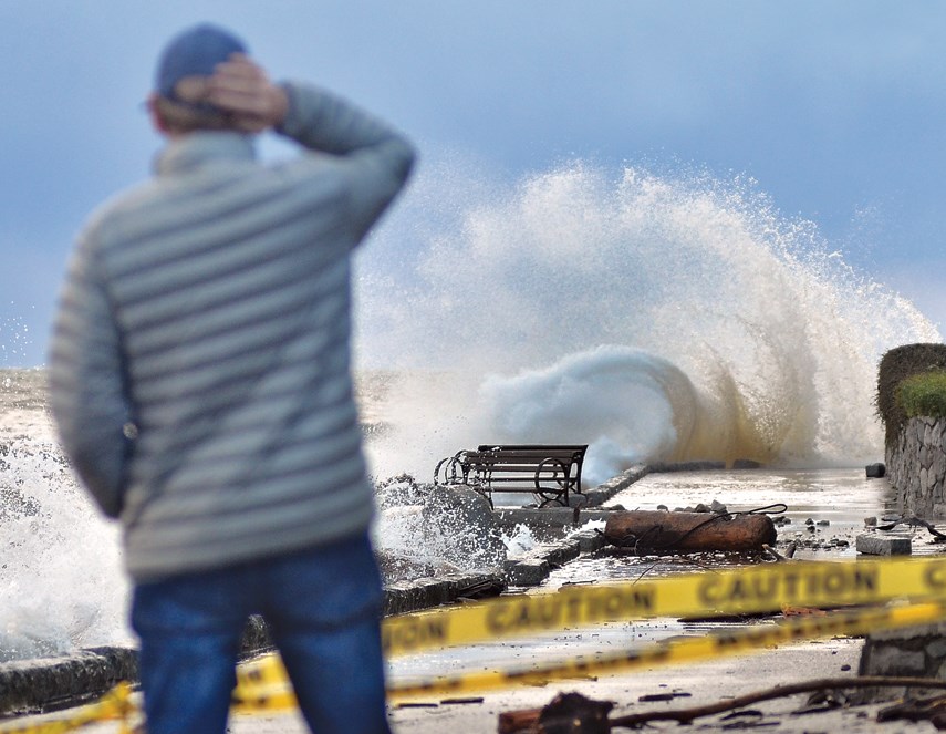
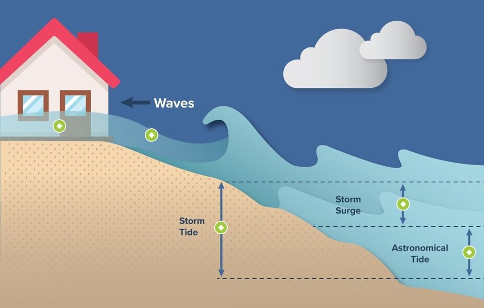
Coastal flooding due to a storm surge occurs when wind driven by storms piles up water onto a shoreline. Storm-driven waves and high tides can heighten the effect, causing damage to infrastructure and putting people’s safety at risk.
Human-caused climate change is also raising global sea levels at an observed rate of about three millimetres per year.
Two-thirds of that is due to melt-water from land-based ice sheets and mountain glaciers, while the remaining one millimetre comes from thermal expansion of the world's seas, according to the U.S. National Aeronautics and Space Administration (NASA), which monitors the phenomenon.
Modelling also suggests climate change will drive more extreme weather events. Together with global sea level rise, the Canadian government forecasts "the severity of coastal flooding events in Canada is expected to increase.”


